XC-skies info:
XC-skies says that there is good lift potential and little wind at the top of usable lift, good.
 Three day point forecast for Bogus. It looks like yesterday's point forecast in that the following day looks like better potential than today.
 I still don't understand what all the lines mean on the skew-t chart:
 Hmmm...potential OD? or scattered showers that we would be able to fly and deal with?
 Dr. Jacks info:
 General weather for today:

The local sky-god Mark Devries called a few minutes ago to get an update on our attempted flights yesterday. Chatting with Mark confirmed what I was guessing last night: the high pressure in the valley squelched any hope of climbing out.
I asked Mark if he would have gone to 8th st. or Bogus yesterday or today, "Absolutely not." I asked him what he looked at to know if the pressure was too high in the valley. Mark says that he doesn't look at anything, he just follows his gut instincts. "For this valley the forecasting tools often make it look like it will be a great day of flying. They are almost always wrong. It will show a great day and in reality all you get is a sledder. Other times the tools show an ok day and you can go all the way to base."
So the trick to understanding the soaring weather in the Boise Valley is simply 12+ years of flying and a gut instinct. "I look out the window and get a sense of how much brown junk is hanging over the Valley, and I look at what the clouds are doing at 10:00 am, I think about how much the valley cooled off the night before and how hot it is supposed to get today and make my decision based on that."

I asked Mark what he thought about getting out of the valley and heading to Idaho City when we have super super stable high pressure days in the valley. Mark's opinion is that if you are going to drive the 1.5 hours to Idaho City, and the hour to launch you may as well just take the whole day off and drive to King Mtn. Horseshoe Bend doesn't have a launch that is high enough to allow you to climb out either.
Then I asked about Bennett Mtn.
Mark went on about some info passed to him from Hang Glider pilot and owner of King Mtn. Gliders, Allen Paylor. "When Allen was working at the Mtn Home air-force base and we had high pressure stable conditions in Boise he would go launch Danskin late in the day (2 or 3 in the afternoon) and often made it all the way back to Mtn. Home."
Mark's theory is that the long rolling approach of foothills on the way to Danskin creates a barrier that separates the super stable high pressure Snake River Plain air mass from Danskin Lookout.
It only got down to 60 last night, which is warm for this time of year. Today looks similar to yesterday.
Danskin it is. I'm excited to fly a new site.
Danskin's 3-day point forecast:

RE-CAP and FLIGHT SUMMARY:
First off thanks Mark D. for chatting and sharing all the local theory/knowledge. Sharing info is fun and appreciated.
Tyler- Thanks a ton for driving retrieve, it's all you next time around.
My track log. This is a .kmz file that you can open with Google Earth.
Tyler and I left Boise at 12:15. The sky looked a little overcast, we were a bit worried that things would not be allowed to develop, or that it would suddenly overdevelop.
I've decided that there are two separate air masses in the immediate Snake River Plain. The air masses often mix between Micron Electronics and somewhere around the Simco Road Exit. On many occasions I have experienced gust fronts and sudden rain showers on this section of the freeway when returning or leaving Boise. Has anyone else experienced this as well? I would like to hear Kangus talk about the local air masses.
As we left town a high altitude N-S trending (what I would describe as a potential squall line) band of dark clouds with whisping sections stretched from the Snake River, north towards Idaho City. We continued driving to Danskin Lookout with our fingers crossed that this band of clouds would dissipate.
Looking N. to the Trinity Mtns and Prairie Idaho atop the basalt canyon of the S. Fork Boise River:

How many of us have flown from Trinity Lookout on Google Earth?:

Looking east from the Danskin Lookout. The rocky outcrop is in the South Facing bowl below the lookout and produced great lift yesterday.

The Drive to Danskin Lookout is further than I had expected, but beautiful this time of year with all the green-up, standing water, red-winged black birds, rocky outcrops, flowering bitterbrush, Lupine and Mule's Ear, and all the young newborn cattle. We even saw a G.B.H.

When we arrived at launch the sky to the south and west had completely cleared, cycles were light to non existant, the Trinity Mtns. were booming, the Owyhees were booming, and a big one was developing on the N. side of Bennet Mtn.
Looking N. to the Trinities. In the lower left hand corner you can see some cu's were popping to the N. and E. of Bogus Basin:

Tyler and I looked at maps, talked about roads, possible routes, retrieves, watched the sky, and we each left a deposit at the bank - bring your own camp cash.

Small clouds began to develop to the east and south of the lookout. Eventually clouds developed on the the transition zone from desert floor to rolling foot-hills. The clouds formed a loose street to the south of launch (well outside of glide) which trended E-W almost from Lucky Peak longitude to well E. of the Bennet Hills.
Looking east in the direction of Bennett Mtn. The dirt road in the image connects Highway 20 to the Cow Creek sportsman's access on the S. Fork of the Boise River. I heard that the fishing hasn't yet turned on there this year. Soon.

Looking N. across the river to Prairie, Idaho:


Clouds developed and dissipated, developed and dissipated. We witnessed no locals, and the cycles felt super super light and far between. We each felt that we have launched too early on too many occasions so we waited for things to develop further. We waited. We waited. We waited and finally we decided that we would simply take a sledder back to the car.
We laid out our wings, stood around on the hot rocky surface sweating ourselves thin and waited for a launchable cycle. We waited. We waited, and we waited.

We finally launched into a very light cycle at about 4:40 with an eye on overdevelopment in the Trinities and N. of Bennet Mtn.. The desert floor remained cloudless, slightly hazy, high pressure, obvious sink.
We launched towards the West. Tyler worked down a ridge line to the left of launch, had a great climb and tried to push west towards the smaller cloud streets setting up in a line towards Boise.
I launched turned right, found a couple bubbles that got me even with the lookout tower and allowed me to work back to the saddle to take advantage of cycles rolling up from the west face and also from the south facing bowl.
As Tyler left his thermal and pushed west looking for a second thermal he started to get low. He worked what he later described as disorganized lift coming off a rocky ridge and eventually landed near his car.

I climbed in steady, incredibly smooth, ample lift, drifting east and a bit south into what Mark later identified as the Danskin House thermal.
I climbed to about 12,000 with an eye on the growing clouds and especially on the patch of grey above my head. When I felt like I was about 1,500 below base I pointed towards the desert, away from the main lift and went half bar. I continued to climb at a slow rate (after I looked at my track log, I've reconsidered whether or not that was a slow rate of climb) until I got to the leading edge of the thermal when I hit some sudden up, enough to convince me to pull ears. I pulled ears flew with 3/4 bar to sinking tones and smooth air until I passed in front of my cloud.
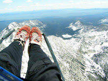
My highest point was around 13,800, which turned out to be at least 1,000 below base.
I went on glide towards Mtn. Home, had a personal jet fly relatively close over head, and bubbled my way on bar to two more clouds. The clouds were in line with the desert floor/foot-hill transition.
The air remained relatively smooth for the entire flight. Once over the desert I pointed things more or less towards highway 20 and tried to find the sweet spot on the bar somewhere between half and full that gave me the best glide ratio.
During glide I was in quite a bit of sink, 250-500 feet per minute down, which I was perfectly happy with as I watched conditions begin to become less ideal as compared to when we had lauched. In the distance the Owyhees began to show virga, as did the Trinities to the North. High thick cirrus began to move in from the west, which I assumed could help slow and shut things down. I continued on glide in light wind conditions averaging between 35 and 45k/hr with glide ratios fluctuating between 2:1 and 11:1 and usually around 4:1
I got a bit cold for a while. Things warmed and were very pleasant at 8,000, things got warmer again around 7300, and downright hot at 6500 msl. I wished that my condom catheter order had arrived like yesterday. No pee-tube was a bummer.

I landed on the east side of highway 20 before the road turns up the basalt grade to Rattlesnake Junction.
Distance: 14.16 Nautical Miles
Max Height:13,800
Gain:7,110
Right on, Right on.
I think Mark is on the money with his analysis that the Bennett Foothills provide a buffer and transition zone between the Snake River stable air mass and everything to the North. The line of lift and transition zone was completely apparent.
I also think he is right in that on the weekend we should all be out there flying in the afternoon, and hanging out to see how well it glasses off in the evening. Why wouldn't it glass? It would be incredible. (I also think that if someone had a sled, this would be an incredible place to fly speed wings in the winter.)
The Boise pilots should be spending Friday and Saturday nights camping at Bennett Mtn withmtn. bikes, .22 rifles, some beer cans, some paragliders, some steaks, some bonfires, the kids, the girlfriends, the camper trailer. How much fun would that be? X-C during the day, glass offs in the evening, and steaks and beers before crashing out in the sleeping bag. Life really could be that good.
A couple things I took away from the day:
1. When the Boise valley is set up with it's super super stable air mass, get out of there and go fly Danskin.
2. Even if there is no cloud directly over head as soon as clouds start to bubble around Danskin, get in the air, it may be trickling into launch, but it is probably right on the money and going up out in front of launch, especially with clouds of obvious lift in other directions.
3. 5,000 feet might be a magic number for getting out of the super super stable Snake River Plain air mass. In flight Tyler and I both notice a different feel to the air around this elevation. The Danskin foothills are at about 4500.
4. Terrain can act as buffers between air masses, the South Fork of the Boise to the North of Danskin probably also helps things cool down at night relative to the non-cooling that happens at night on the Boise Front mtns.
5. Keep an eye on developing conditions. I am happy with my decision to leave lift and the clouds and head for the desert when I did. I hung out in the sink and landed with plenty of time before things committed themselves to nastiness. An hour and a half after I landed, as we ran the shuttle, lightning connected clouds and virga started to fall out.
6. The X-C potential seems HUGE from this site. Think about how many days you've seen things streeted up from Mtn. Home towards the east when driving between Twin and Boise. So far as I know all that has been done here is Eddy's climb and glide to Mtn. Home last year and this single climb and single glide this year. The Boise pilots should start connecting things and fly to Ketchum, Glenns Ferry and beyond. On a good day commit to the no-mans land of the Bennett hills and I bet you will make it through them.
7. We need to fly this site more often, find out if and how it glasses off, and someone needs to buy a snowmobile so we can speed fly here in the winter.
After dinner with Tyler in Boise I met another pilot/friend/photographer Thia Konig for the majority of the all female AC/DC tribute band Hell's Bells at the Knitting Factory. I arrived just as the lead guitarist was strip teasing down to her bra and mini-skirt - high energy, entertaining, TOUGH Chicks.
Anything else?