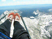
Monday was the first day of competition. We had great conditions and about 14 pilots made it to goal. I launched close to last as I was taking photos on launch. Once in the air I had a good climb but my GPS ruined an otherwise potentially enjoyable flight. I spent the entire flight staring at the grey screen trying to figure out where I was in relation to the turn points.
My flight ended as I searched for light afternoon lift and instead found a bush. It took me 45 minutes to fish my wing out the thorny branches. All the while it sounded like the neighbors were strangling cats. On my hike out I passed a cock-fighting farm. If you have google earth download my track log and see the bush I picked as an LZ
There have been a few glitches in the event organization and the spot tracking device that I had rented hasn't yet arrived. When it does arrive I should be listed as pilot 35.
On launch:
 . On launch Connie, the co-meet director describes where we can't land. For such a large valley there are very few options according to Connie.
 "See the first pond on the left? Ok, don't land to the left of the pond, that is Dan's LZ, we are NOT ALLOWED to land at Dan's LZ. Clear? Ok, good. See the dirt road with the dog-leg? You can land to the left of that road, but not to the right. See the rectangular dirt patch? That land owner has arabian horses, we can land there, but if you see horse or people riding horses warn them that you are coming in to land. Clear? Ok. See the school across the valley? DO NOT LAND at the school. They WILL call the Sheriff. Clear? Ok, good. See the red barn? Ok between the red barn and the dog leg road, all the way out to the main road and over to the next pond is a DO NOT LAND ZONE! Clear? See the dump? It looks like there are a lot of trees there, but we can land there. That is a designated landing zone, in fact I land my hang glider there. Ok, see the next valley over? That valley is ok, but the next valley beyond that is not. Clear? Ok, see the .....":
 pre flight game faces


 GOAL!
GOAL! Hayden:
 Bradley:
 Greecie:
 Josh?
Josh?


 Pete:
Pete:

 Nate Scales:


 Andy:
Andy:


 Mook:
Mook: